
Town of Union ZIP Code Coverage
Town of Union has postal, village, hamlet, and legal-municipality labels in the same area. This ZIP code directory lists the delivery labels found in the research, but it does not turn a postal code into a boundary map. Confirm the full street number with USPS, then use the municipal and parcel fields for tax, court, and records routing.
| ZIP | Areas Covered | Post Office | Notes |
|---|---|---|---|
| 13760 | Endicott and Endwell address references | Endicott PO and Endwell delivery references | Broad standard ZIP. Postal city does not establish a town or village boundary. |
| 13762 | Endwell label in address sources | Verify each delivery point with USPS | Likely reaches part of Endwell geography; no exact municipal ZIP map was located. |
| 13790 | Johnson City label | Verify each address with USPS | Johnson City is an incorporated village in the wider Town of Union context. |
| 13905 | Binghamton label along the wider Union and Broome edge | Verify each street with USPS | Authoritative exact Town of Union boundary coverage was not located. |
| 13761 and 13763 | Possible Endicott post-office, box, or route associations | Exact-address USPS confirmation required | Do not treat either as universal Town of Union delivery coverage. |
Endwell, Endicott, Johnson City, and Binghamton can appear as postal labels even where the underlying parcel is in Town of Union or an incorporated village. A 13760 result is a strong delivery clue, not a statement about tax jurisdiction, court venue, voter district, or municipal limits.
Town of Union includes the incorporated villages of Endicott and Johnson City, plus unincorporated or hamlet identities including Endwell, West Corners, North Endicott, West Endicott, Union Center, Fairmont Park, Westover, and Choconut Center. That local mix is why the full address matters more than a postal city label. Keep the ZIP, postal city, municipality, and parcel ID as separate fields instead of treating them as interchangeable.
Town of Union ZIP Delivery Labels
USPS assigns a ZIP code to a delivery point. The Town Assessor and Broome GIS identify the legal municipality and official 911 address. Those systems can agree on an address but serve different purposes. Use the USPS ZIP Code Lookup for the postal code at a specific street number, then check the parcel record when the question concerns local jurisdiction.
A postal city name is especially weak evidence for a government route. ZIP alone cannot establish municipality, tax jurisdiction, court jurisdiction, or voter jurisdiction. The research did not locate one authoritative USPS map that proves every Town of Union parcel-to-ZIP assignment, so 13761 and 13763 stay in the “verify first” category.
Town of Union ZIP Search Filters
Broome Image Mate is countywide by default, so a ZIP result needs a second municipal check. Its ZIP selector narrows delivery geography, while the Municipality selector distinguishes the legal parcel jurisdiction. The two filters work best together, followed by a review of the parcel address and parcel ID.
| Image Mate field | How it helps a ZIP search |
|---|---|
| ZIP | Limits results to a postal delivery area, not a legal boundary. |
| Municipality | Checks whether the parcel is assigned to Town of Union or another local government. |
| Parcel Address | Uses a full or partial address when the full ZIP is already known. |
| Owner Last Name | Finds an owner-of-record lead, which is not the same as an occupant listing. |
| Parcel ID Number | Carries the result into GIS, tax-map, and recorded-document research. |
Image Mate also offers spatial, assessed-value, school-district, zoning, utility, and environmental filters. They can separate similar address results, but they do not make a ZIP code a legal boundary. Preserve the postal code and municipality values separately in a research note.
A property owner or mailing address is also not an occupancy finding. A parcel result can identify the owner of record and point to the next document, but it should not be used to claim that a named person currently lives at the address. The ZIP filter narrows the parcel search, not the question of who occupies a location.
Find Town of Union ZIP Matches
A useful ZIP-code search moves from a postal delivery point to a local record key. Start with the exact street number and road. TaxLookup, Image Mate, and GIS each answer a different part of the question, so compare their fields rather than expecting one screen to settle the whole address.
- Confirm the exact delivery ZIP with the USPS lookup, including the street number and street name.
- In Image Mate, combine the ZIP and Municipality selectors, then save the parcel ID and parcel address from the matching result.
- Use the Parcel Mapper’s ZIP Code layer and tax-map context to check the parcel’s geographic position and 911 address.
- In TaxLookup, select Union and the correct tax year, then search by street number and name, owner name, tax map, or bill number.
The 2026 Town of Union TaxLookup screen shows the local search choices and year selector.
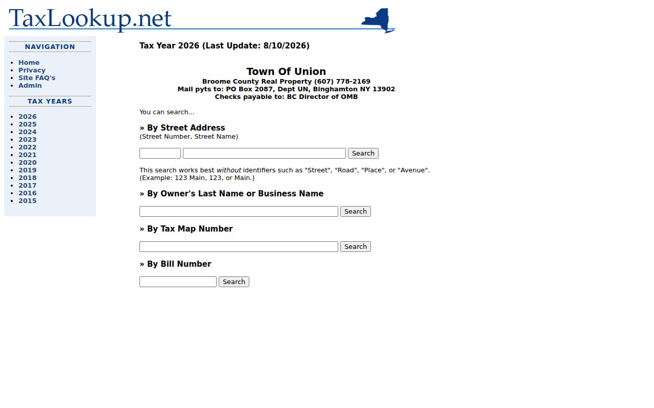
TaxLookup links the Union page to tax years from 2015 through 2026. It accepts a street number and name, owner last name or business, tax map, and bill number, so record the selected year with every result.
The page also distinguishes jurisdiction choices from school-district choices. Select Union for a Town tax question, then verify the tax map and parcel fields before sending a request to an office. A school label can add useful context, but it is not a substitute for the municipality field.
Town of Union Parcel Map Check
The Broome GIS Parcel Mapper is the stronger tool when a ZIP result needs local map context. It searches by Parcel ID Number, Owner Name, or Parcel Address, and its map includes ZIP Code and tax-map layers. GIS also maintains 911 addresses and tax maps for Broome County’s towns and villages. Its product is a public reference, not an official survey, so an office should resolve any formal boundary question.
The Broome Parcel Mapper displays search controls, layers, and the GIS public-reference notice.
Use the map to compare the 911 address, tax-map setting, municipal context, and the ZIP layer rather than relying on a colored postal boundary by itself.
Once a ZIP has narrowed the area, a street-by-street record trail belongs in the Town of Union street directory. That route carries the exact address through assessment, tax, GIS, and deed sources without turning a postal code into a resident list.
The map also includes layers for municipal zoning, school districts, polling places, services, water and sewer, flood conditions, and aerial photography. Those layers describe a parcel’s setting. They do not change the legal status of the address or prove a parcel’s delivery ZIP, so retain the Parcel Mapper’s public-reference limitation.
Town of Union Historic Name Pivots
Old address work has a local twist. Lestershire incorporated in 1892 and became Johnson City on March 21, 1916. Endicott incorporated in 1906, and the Endicott and Union villages merged in 1921. A historical directory or deed can therefore use Lestershire, Johnson City, Union, or Endicott for an area that now has a different postal label.
This is a useful comparison between postal and historical geography. Search the person, road, and time period with the old place name as well as the current label. The 1921 merger does not make every old Union reference an Endicott address, but it does explain why a straightforward modern ZIP search can miss a historical record.
Route 17 construction in 1967 also removed homes and the old ballpark in the Johnson City area. When a road or address is missing from a current ZIP or parcel search, add a dated directory, historic map, newspaper, or aerial image to the research trail. A modern delivery label cannot repair a changed street landscape by itself.
Note: A historic place label is a search term, not a substitute for the dated record’s actual municipality or address.
Town of Union ZIP Code Boundaries
ZIP code boundaries and Town of Union limits are different systems. A postal ZIP may cross a village edge or use a nearby postal city name. TaxLookup offers Broome County jurisdictions such as Union and school-district choices including Maine-Endwell and Union-Endicott, which is another reason to record the jurisdiction selected rather than infer it from the ZIP.
The Town’s 23,000-parcel assessment figure is an office workload description, not a count of occupied households. Population estimates and ZIP delivery areas are different measures too. For a record request, preserve the full delivery address, ZIP, municipality, parcel ID if known, tax year if relevant, and the correct custodian.
When USPS, GIS, and the parcel record disagree, ask the responsible office which field controls the request. Do not guess from a postal label.
Broome GIS maintains 911 addresses and tax maps for 16 towns and 7 villages. That countywide role explains why its map can place an address in geographic context while USPS remains the authority for the delivery point. A boundary question needs both systems, and sometimes the municipal or county office that owns the record.
Town of Union ZIP Code Terms
These terms keep a Town of Union ZIP code directory useful without overstating what postal data proves.
- ZIP code
- A postal delivery code assigned by USPS to an address or delivery point.
- ZIP+4
- An added four-digit delivery detail that narrows mail routing within the five-digit ZIP.
- PO-box ZIP
- A ZIP used for post-office boxes and not automatically for every nearby street delivery address.
- Unique ZIP
- A code associated with one large recipient or organization; it does not describe a whole municipality.
- Carrier route
- A mail-delivery route within a ZIP, useful for postal operations but not a municipal boundary.
The full address remains the key. Verify its ZIP with USPS, its municipality and 911 context in GIS, and its tax or parcel reference with the correct Town of Union source.